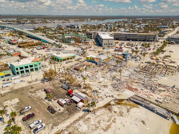
A rare September nor’easter shoved the Atlantic straight into East Coast streets while governors hit the emergency switch.
Story Snapshot
- New York and New Jersey declared states of emergency as the storm moved in.
- Forecasts warned of coastal flooding, damaging winds, and large waves from the Mid-Atlantic to New England.
- Roads flooded in several shore towns, with travel and power disrupted across the region.
- Federal summaries also logged emergency declarations in Maryland, Virginia, and North Carolina.
Governors Move First As Seas Surge And Winds Rise
Governors in New York and New Jersey declared states of emergency ahead of peak tides and wind, urging people to stay off the roads and away from the surf. The Federal Emergency Management Agency daily briefing noted similar emergency declarations in Maryland, Virginia, and North Carolina as the system pressed north. These moves unlocked extra crews, faster contracting, and quicker coordination. That matters when every hour of daylight determines how many pumps, tow trucks, and utility teams can get into place before the next high tide cycle.
National outlets flagged the threat with blunt language: widespread coastal flooding, dangerous surf, and strong onshore wind from the Carolinas to southern New England. Forecasters called out one to three feet of flooding above high tide in many coastal zones, with higher pockets near inlets and bays. That is enough to turn low-lying causeways into lakes and push saltwater into basements. Rip currents and beach erosion topped local alerts as steady northeast wind stacked water toward the shore.
Local Impacts: Flooded Roads, Downed Lines, And Washed-Out Plans
Reporters on the ground described roads underwater in New Jersey shore towns as storm tide and rain arrived together. Video showed seawater seeping across barrier island streets and overtopping bulkheads during peak tide windows. Airlines and Amtrak issued no-fee waivers to give travelers room to shift plans around the worst of the weather. Power companies logged tens of thousands without electricity at points during the weekend push, a predictable result when saturated ground and gale gusts combine. Beach towns saw visible dune cuts that will need repair.
Wind warnings highlighted the other main hazard. Gusts reached levels that snap limbs and drop older lines, with advisories extending through big population centers like Philadelphia, Providence, and Boston. Crews staged bucket trucks and extra call centers to speed restoration as circuits tripped. Local police closed low bridges and flood-prone underpasses to stop stuck cars from becoming rescues. Small choices like moving a family SUV off a street that floods every fall became the line between a close call and a claim.
Why This Setup Hits Hard In September
The nor’easter arrived during the seasonal handoff, when warm ocean water feeds energy into early cold fronts. A stubborn northeast wind over multiple tide cycles acts like a slow faucet left on. Water piles into bays, then cannot drain before the next high tide. That timing loads the dice for nuisance spots to become problem zones. Waves across the continental shelf also grow under a long wind fetch, which grinds away dunes and throws sand onto roads and boardwalks. Shoreline managers plan for this pattern every fall.
Emergency managers treat the coastal strip as a system, not a set of dots. When New York and New Jersey pulled the emergency lever, it signaled shared risk across ferries, commuter rails, and evacuation routes. The Federal Emergency Management Agency tracking of declarations farther south reflected the same view: this was one storm with local faces. That cross-state posture tends to line up with American conservative values of preparedness, local control, and clear lines of authority. You plan, you stage, and you let counties lead with state and federal backup.
What Comes Next: Repairs, Data, And A Clock Ticking Toward The Holidays
Beach towns will measure how much sand they lost, then schedule dune repairs before winter storms take another bite. Transportation crews will inspect causeways and patch scoured shoulders. Utility companies will dig into outage logs to harden weak spots. Federal teams will line up post-storm data, including tide gauges, buoy readings, and aerial surveys that help refine flood maps and project lists. Those records turn a long weekend of warnings and water into plans that save time and money in the next round.
2 AM Top-of-the-Hour News
Flooded streets. Downed trees and power lines. 150 thousand in the dark from Pennsylvania to Rhode Island. Hundreds of flights cancelled. Thousands more delayed. A powerful Nor-Easter slamming coastal areas from New Jersey to New England. New York… pic.twitter.com/yQGGcdEImV
— Worldwide News Network (@WorldwideNNX) September 27, 2026
Households can use this event to run a simple drill. Map the nearest high ground. Note which intersections flood first. Keep a small battery pack, a cooler plan for medicines, and a car charger ready. These are low-cost steps that pay off when tides rise. Municipal leaders should capture what worked: which alerts moved people, which barricades actually blocked traffic, and which pump stations needed more capacity. Coastal risk is not abstract here. It knocks at the door a few times every fall and winter.
Sources:
facebook.com, fmcsa.dot.gov, abcnews.com, weather.gov
© truthandliberty.com 2026. All rights reserved.